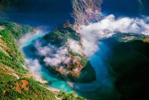
Before reaching Bingzhongluo, you will first pass by the First Bend of Nujiang River. Here, the Nujiang River makes a sharp turn from west to east, forming a U-shaped bend. The First Bend of Nujiang River is about 4 kilometers from Bingzhongluo and is a landmark attraction of the Nujiang Grand Canyon. The viewing platform is located by the roadside, and visiting early in the morning allows you to capture the scene of the clouds and mist dispersing over the first bend.
Bingzhongluo Scenic Area
About 10 minutes past the First Bend, you will reach Bingzhongluo. Bingzhongluo Town is essentially a 500-meter-long street running north-south, with the town situated on both sides of the road. The Bingzhongluo Basin is at an altitude of 1,750 meters and is an open terrace in the Nujiang Gorge. The sea breeze from the Indian Ocean makes the climate here mild and presents a pastoral landscape. Legend has it that ten sacred mountains surrounding the basin protect Bingzhongluo, with the rocks and trees being guarded by spirits. Therefore, Bingzhongluo is also known as 'the place where humans and gods coexist.'
Big Sand Flow
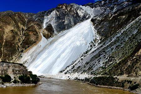
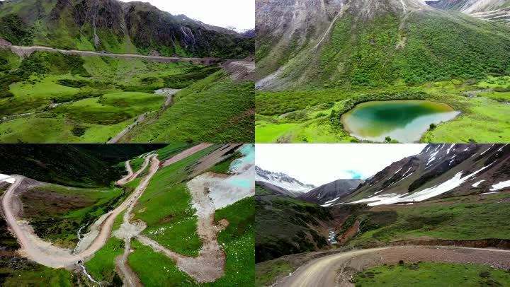
From the crossroads in Bingzhongluo Town, heading east is the Bingcha Road. After passing the Yunnan-Tibet border along this road, the road changes from asphalt to a narrow gravel road. After slowly passing through Small Sand Flow and Big Sand Flow, you will reach Chawalong. Big Sand Flow is actually a landslide formed by weathered mountains, reaching a height of 300 meters and resembling a glacier.
Muruo Village is a highland pasture located in a valley area, with an altitude of 3750 meters. The climate is colder than Chawalong. Currently, Muruo Village is still in the development stage, with only a few restaurants and hotels. You can take a break here at noon and continue to head towards Chayu in the afternoon.
Yixiu La
After passing Guomu Ruo Village, most of the route is above 3000 meters in altitude. Along the way, you will pass through the Changla Pass at an altitude of 4498 meters and the Yixiu La Pass at an altitude of 4706 meters. The scenery at the pass on the plateau's peak is even more captivating, with exposed rocks as far as the eye can see. Occasionally, you can spot herders and grazing yaks, adding a sense of serene majesty to the primitive desolation.
After crossing the Yixiu La Pass, the journey is mainly downhill, and driving should be done with extra caution. After about an hour, you will reach Sangjiu Village, and after driving another 20 kilometers, you will arrive at Chayu County. 'Chayu' means 'a place where people live'. It borders Myanmar and India to the south and is adjacent to Motuo to the west, with an altitude of over 2000 meters. The climate here is mild and humid all year round, and the scenery is very different from the typical Tibetan landscape, hence it is also known as the 'Little Jiangnan of the Snowy Region'.
Renlongba Glacier
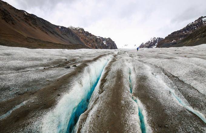
The entire journey from Chayu to Baxoi is paved with asphalt, allowing for a thrilling ride on the plateau. The day's itinerary is divided into two segments: in the morning, depart on S201, crossing the Demula Pass at an altitude of 4900 meters, passing by the Renlongba Glacier. The Ranwu area is known as the 'Land of Glaciers.' If you want to truly experience the glacier, it is recommended to visit the Renlongba Glacier when you reach the border between Chayu and Ranwu. Here, you can easily climb onto the long ice tongue.
Ranwu Lake and Laigu Glacier
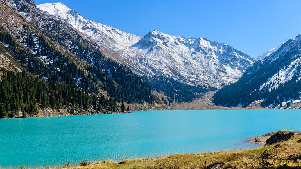
Ranwu Lake is located in the southwestern corner of Baxoi County in the Chamdo region, a 30-minute drive from the Renlongba Glacier. Ranwu Lake is a highland barrier lake formed by landslides, with water sourced from the melting snow and ice of the Laigu Glacier to the north. The long, narrow lake is divided into eastern and western sections by mountains, surrounded by snow-capped peaks, grasslands, dense forests, and Tibetan villages scattered along the lakeshore.
Midui Glacier
Travel west along G318 from Ranwu Lake for about 1 hour to reach the famous Midui Glacier. The scenic area is only 8 kilometers from G318, making it easily accessible. The main peak of Midui Glacier has an altitude of 6800 meters, with a snow line at only 4600 meters. It is worth a detour to visit on the way to Bomi.
Nujiang
Nujiang 72 Turns is a must-pass place on the southern Sichuan-Tibet line, with a total length of 12 kilometers. This place is famous for its steep slopes and dangerous roads, with over 130 bends according to statistics. Vehicles travel from an altitude of 3100 meters, winding up the mountain, crossing the Nujiang Gorge, climbing to the highest point of 4651 meters, and then winding down the mountain again.
