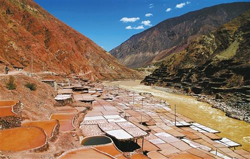
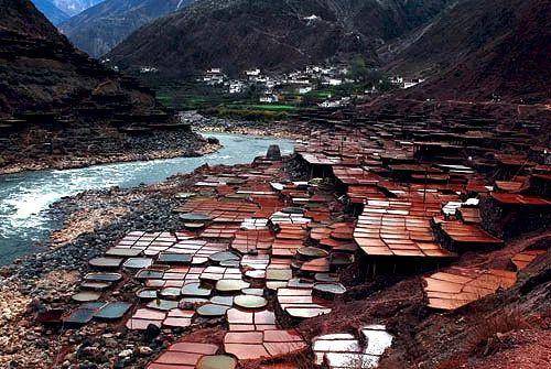
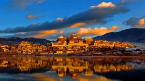
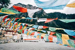
Yanjing Scenic Area
Located in Naxi Ethnic Township, Mangkang County, 107 kilometers from the county seat, on both sides of the Lancang River along National Highway 214, at an altitude of about 2300 meters. 'Yanjing' is named after its salt production, and its Tibetan name is 'Cakala', where 'Ca' means salt, indicating a place where salt is produced. According to historical records, Yanjing has a history of sun-drying salt dating back to the Tang Dynasty, over 1200 years ago. Here, you can experience the simple folk customs. When you see the stalactite crystal salt inside the houses, you will be transported into a world of crystal palaces, presenting a natural and beautiful grand spectacle before your eyes.
Honglasha Yunnan Snub-nosed Monkey National Nature Reserve
Honglasha Nature Reserve, later renamed Mangkang Yunnan Snub-nosed Monkey National Nature Reserve, is located 60 kilometers from Mangkang County town, with a width of 30 kilometers and a length of 80 kilometers. The reserve has a high latitude, high mountains, and deep valleys, creating a prominent three-dimensional natural landscape. The altitude ranges from 2300 meters to 4448 meters, with different vegetation distributed at different altitudes, making it a kingdom of plants and a gene pool for the study of flora and fauna. The reserve is home to three families of Yunnan snub-nosed monkeys. In addition to the Yunnan snub-nosed monkeys, there are many rare national first and second-class protected animals and valuable medicinal materials. It is the hometown of Mangkang red pine and a kingdom of forests.
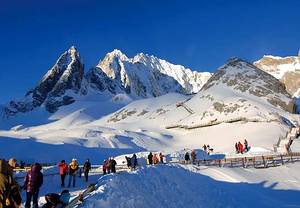
La Wu Mountain
La Wu Mountain is located in Mangkang County, Tibet Autonomous Region. It is a gentle pass within the Mangkang section of the Sichuan-Tibet Highway (National Highway 318). Although this pass is relatively gentle, the magnificent scenery of La Wu Mountain is filled with the breath of nature, attracting many tourists every year. Unlike other mountains that are densely green, a major feature of La Wu Mountain is its sparse and rare greenery. From a distance, one can notice that the discontinuous greenery on La Wu Mountain is one of its main characteristics.
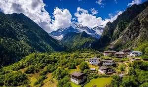
Jueba Mountain
Jueba Mountain (also known as Jiaoba Mountain) is located from Batang in western Sichuan to Mangkang County and Zuogong in eastern Tibet, situated in the Three Rivers (Jinsha River, Lancang River, Nu River) basin of the Hengduan Mountains, surrounded by the Anjula Mountain, Boshula Ridge, and Laowu Mountain. The 30-kilometer winding mountain road of Jueba Mountain on the Sichuan-Tibet Highway, from Zhuka Village to Dengba Village in Mangkang County, Tibet, with a relative height difference of nearly 2000 meters, has become the most difficult and time-consuming mountain to climb on the Sichuan-Tibet line. The mountain is not high, but the elevation difference is significant: the pass is at an altitude of 3940 meters, and the Lancang River cuts deeply, with steep cliffs on the riverbank. Many warning signs are erected at the entrance to the mountain, reminding travelers to be cautious of falling rocks, landslides, and mudslides. The mountain experiences four seasons in a single day, with sudden changes in weather.
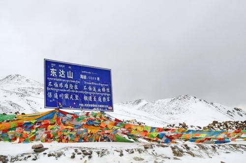
Dongda Mountain
Dongda Mountain is the second highest pass on the Sichuan-Tibet Southern Line, located in Zuogong County, Tibet. The pass has an elevation of 5008 meters. In summer, the grasslands are green, yaks roam in herds, and the scenery is extremely beautiful. Be mindful of altitude sickness and bring products to counteract it. The mountain road is no longer winding and twisting but a straight road leading forward, long and gentle, with no end in sight. This is the longest and most winding Dongda Mountain on the Sichuan-Tibet Line. A blue road sign erected by the armed police reads: Dongda Mountain.
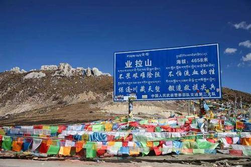
Yela Mountain Pass
Yela Mountain is a high mountain located between Bangda and Basu in Tibet, with an altitude of over 4600 meters. This height is not considered significant on the Qinghai-Tibet Plateau, but the mountain has significant undulations and a high relative height. From east to west, starting from Bangda, the undulation of Yela Mountain is only over 600 meters. From west to east, starting from Basu, the undulation reaches up to 1500 meters. The mountainous scenery of Yela Mountain is famous along Route 318 for its varying elevation differences.
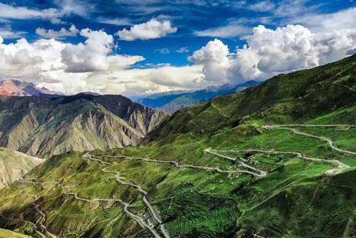
Nujiang 72 Turns
After crossing Yala Mountain, you will reach the legendary 'Nujiang 72 Turns,' which is one of the most dangerous sections of the Yunnan-Tibet route. In reality, there are more than 130 bends, hence it is also known as the 'Ninety-Nine Hairpin Turns,' indicating the perilous nature of the road.
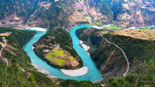
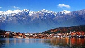
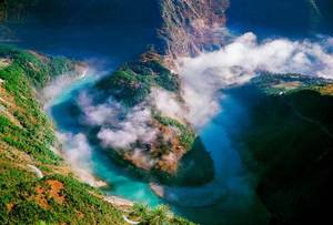
Nujiang Grand Canyon
Nujiang Canyon is located in the Hengduan Mountains longitudinal valley area, where the Nujiang, Lancang, and Dulong rivers flow parallel. The canyon reaches a maximum depth of 3500 meters, earning it the nickname 'Grand Canyon of the East'.