Four-day self-driving tour on the Xilin Gol Grassland in Beijing
2 cities |
7 attraction(s) |
total distance 369
km
 TIPS
TIPS
Day1
Day2
Day3
Day4
Day1: Zhangjiakou
2 attraction(s) ·
29 km

2
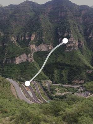
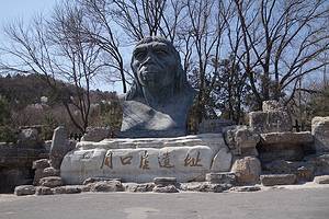
The Badger Mouth

It is the western entrance of the Grassland Sky Road, with steep mountains and strong winds. Geese often fall when they encounter strong winds. In ancient times, it used to be a famous military pass.
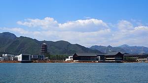
Day2: Xilin Gol
2 attraction(s) ·
80 km
1
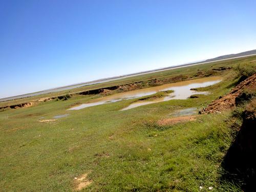
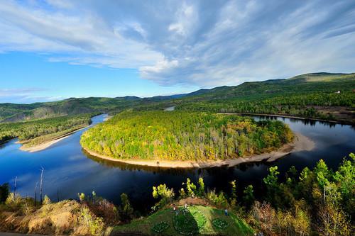
Xilin Jiucu is located about ten kilometers southeast of Xilinhot City. It is a beautiful bend of the Xilin River. Many photography enthusiasts have created masterpieces of this scenic spot. The 1998 special stamp issued by Xilin Gol features this location as its background. Here, the river surface is open, with steep slopes on the left bank and gentle slopes on the right bank. The Xilin River has formed numerous bends due to frequent oscillations of its riverbed. The riverbanks are covered with reeds and other aquatic plants, adding to the beauty of the river bends. Downstream from this bend is the Xilin River Reservoir, a popular fishing spot. The riverbanks are adorned with peculiar and interesting rock formations. It is best to visit this sc
80
km
2

About 30 kilometers south of the road from Xilinhot to Zhangjiakou, you will be able to witness a spectacle of a flat-topped mountain. This mountain is surrounded by a group of peaks of different sizes and shapes, but its peak is as flat as if it were sliced by a knife, forming a unique scene. According to geological research, this flat-topped mountain is the result of volcanic eruptions millions of years ago. At that time, there were multiple volcanic eruptions in this area, and the magma submerged the flat grassland, covering the earth with a layer of thick volcanic rock. Later, due to crustal uplift and subsidence, large areas of flat-topped mountains and horseshoe-shaped mountains were formed. The best time to watch the spectacle of the flat-topped mountain is at sunrise and sunset. At sunrise, the morning glow brushes a faint layer of rouge on the mountain top, making the mountains even more charming; at sunset, the afterglow of the setting sun spreads over the grassland, allowing you to clearly see the sun gradually sinking into the earth. In the evening glow, the rising smoke in the valley evokes countless thoughts.
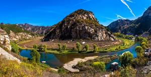
Day3: Xilin Gol
2 attraction(s) ·
261 km
1
About 30 kilometers east of Xilinhot, there is a vast and fertile land called Baiyin Xile, which is a famous natural reserve in Inner Mongolia grasslands. The reserve is rich in grass, with cattle and sheep roaming freely. The hilly terrain and the Xilin River running through it, along with the secondary forest, give the grassland a beautiful scenery. There are also many lakes in the reserve, some of which are used for breeding carp and crucian carp. The most famous is the "Three Scaled Fish," which is known for its delicious taste. The Shan Yang and white birch forest core area is located within the Baiyin Xile ranch, with an enclosed area of 1 square kilometer. It is a natural secondary forest on the shady slopes of the Hulunbuir sand belt, mainly consisting of Shan Yang and white birch trees, occasionally mixed with some bushes. It serves as a transition zone between the forest and grassland, and has high conservation, scientific research, and ornamental value. On the opposite slope, there are mainly wild mountain forests, which display a stunning mix of red, yellow, and green colors in autumn. Shaoyao Gou is located about 1 kilometer north of the Shan Yang and white birch forest. It is home to the protected plant of Inner Mongolia Autonomous Region, Shaoyao (wild peony). When it blooms from late June to late July, the flowers are mostly white and cover the area like stars, creating a breathtaking sight worth lingering over. Huang Hua Gou is located within the Baiyin Xile ranch. It is home to the precious natural wild plant resource of yellow flowers, which are delicious and highly nutritious. During the flowering season, the whole area turns golden, forming a typical grassland landscape with dominant species like Baikal needle grass. When summer arrives, the scenery of bird songs and fragrant flowers makes it a great place for tourism. Lake Zages Tai is located east of the Shan Yang and white birch forest core area. With a lake area of 1.68 square kilometers, it is the largest natural lake in the reserve. The reflections of the mountains in the water, the boats floating on the lake, the forests lining the shore, the deep valleys, the stacked rocks, the chorus of birds and beasts, and the sound of the creek hitting the stones make it a sacred place for sightseeing. Yushu Forest, located southeast of Lake Zages Tai, is in the Huosha hilly area. The terrain here is undulating, with sandy soil as the main component. The naturally grown Yushu trees have diverse and elegant branches, presenting a charming and picturesque view. It is a paradise for ecological viewing, with colorful layers of forests, vibrant with natural beauty.
261
km
2
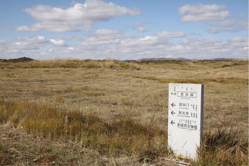
The Yuan Shangdu site is located on the northern bank of the Lightning River, upstream of the Luan River, within the Wuyi Ranch in Zhenglan Banner, Inner Mongolia Autonomous Region. It was built in the sixth year of the Mongolian Emperor Xianzong (1256), initially named "Kaiping Prefecture," and renamed "Shangdu" in the fifth year of the Zhongtong era (1264). It was also known as "Shangjing" or "Luanjing" and served as a summer retreat for emperors and empresses. In the second year of the Ming Hongwu era (1369), it was renamed "Kaiping Prefecture" again, but was soon abolished and replaced by a military outpost. In the fifth year of the Xuande era (1430), it was abandoned. Archaeological investigations were conducted by the Inner Mongolia Autonomous Region Cultural Relics Work Team and Inner Mongolia University in 1956 and 1973 respectively. The Yuan Shangdu site is located on the alluvial plain on the northern bank of the Lightning River (upstream of the Luan River) within the Wuyi Ranch in Zhenglan Banner. It was built in the sixth year of the Mongolian Emperor Xianzong (1256), before Kublai Khan ascended to the throne, and was initially named Kaiping Prefecture. After Kublai Khan became emperor, in the eighth year of the Yuan Dynasty (1271), he changed the country's name to Yuan and referred to Kaiping Prefecture as Shangdu, also known as Shangjing or Luanjing, serving as the summer capital of the Yuan Dynasty. The Yuan emperors would spend their summers here and handle political affairs, so the palace city was built as a garden-style palace complex. The entire city consisted of three concentric layers of walls, namely the palace city, imperial city, and outer city. It had a circumference of about 9 kilometers, with dimensions of 2050 meters from east to west and 2115 meters from north to south. The palace city walls were made of brick with corner towers, and featured halls and pavilions such as the Crystal Palace, Hongxi Palace, Muqing Pavilion, and Da'an Pavilion, as well as artificial ponds fed by river water. The imperial city surrounded the palace city and had walls made of stone blocks, with well-organized roads. The southern half of the imperial city housed government offices and official residences. The northeast and northwest corners had the Qianyuan Temple and Longguang Huayan Temple. The outer city was constructed entirely of earth and stood northwest of the imperial city. The northern part was the imperial garden, while the southern part housed government offices, temples, and workshops. Outside the city, there were marketplaces, residential areas, and granaries in the eastern, southern, and western suburbs. Although it fell into disrepair in the early years of the Ming Yongle era, remnants of the city walls and building foundations still remain. The site is referred to as "Zhao Naiman Su Mu" in Mongolian, meaning "108 temples," which is a misinterpretation due to the numerous buildings at the site. It is a key national cultural heritage site.
Day4: Xilin Gol
1 attraction(s) ·
0 km