4-day trip to Jeju Island
2 cities |
9 attraction(s) |
total distance 50
km
 TIPS
TIPS
Day1
Day2
Day3
Day4
Day1: seogwipo > Jeju-do
3 attraction(s) ·
31 km
2
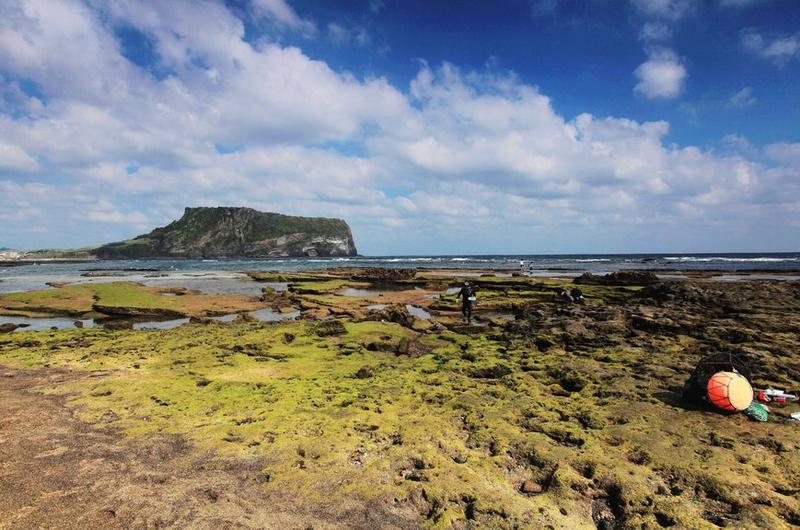
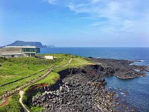
Seopjikoji, also known as Seopjikoji Cape (Sopjikogi, 섭지코지), is located on the eastern coast of Jeju Island. "Seopji" is the ancient name of this area, and "koji" is a Jeju dialect, meaning protruding terrain. On the cliff of Seopjikoji Cape's coastline, there is a broad grassland with no trees in sight, and a rock called Seonseok stands on the coast.
Seopjikoji Cape gained fame initially because of the movie "Il Mare," and now it attracts more K-drama fans due to "Queen In-hyun's Man." The cape is home to a lighthouse and South Korea's earliest TV drama museum, "All in House." On the way to the lighthouse, there is a stone wall for wind control, and inside the wall is a field of rapeseed flowers that shine bright yellow in April. Standing by the railing on the other side of the road, the coastline unfolds before your eyes.
25
km
3
Jeju Island is home to over 360 volcanoes, with Sangumburi being one of the most unique ones. Unlike the other volcanoes on the island, which were covered in magma after an eruption, Sangumburi's crater remained exposed, forming what is now known as the "flat volcanic crater." Featured in the movie "The Wind and the Wave," Sangumburi has been designated as Natural Monument No. 263 by South Korea. With a circumference of 2km, the volcanic crater evokes scenes from the film where characters strolled through it. Apart from Sangumburi, all the other volcanoes on Jeju Island have been covered and piled up with magma after their eruptions. Only Sangumburi's crater was protected by rocks, preventing lava and volcanic ash from spewing out. Such a volcano is known as a low land volcanic crater, and it is extremely rare in both South Korea and the world. Especially at the lower part of Sangumburi, where there are more cracks, the vegetation inside the crater has a unique distribution due to water infiltration. Based on the internal elevation of the crater, it can be divided into temperate and subtropical regions. The distribution inside varies due to differences in sunlight duration and intensity. In the well-exposed northern subtropical region, dominant species are evergreen broadleaf trees like Japanese evergreen oaks, camphor trees, oak trees, and large-leaved evergreen trees, while rarer plants such as yellow grass lily, tiger orchid, and cold strawberries are mainly found beneath them. In the less sunlit southern region, there are communities of temperate deciduous trees such as Chinese cork oak, dogwood, maple, and Korean black pine. Moreover, this area preserves complete and intact communities of rare plants like gold-edged primroses, Cremanthodium, Jeju bamboo, sidehanging bellflowers, and mountain edge flowers, which are rarely seen elsewhere, making it of high academic value. Various mammals such as deer and badgers, as well as birds and reptiles, also inhabit and reside in this area. In spring, white clouds often hover below the volcanic crater, creating an enchanting scenery. Natural-colored flowers like plum blossoms and Gentiana decorate Sangumburi, adding a mysterious atmosphere that attracts visitors.
Day2: Jeju-do
1 attraction(s) ·
0 km
1
Mount Hanra, with an elevation of 1950 meters, is the highest mountain in South Korea. Its summit is a volcanic lake called Bailutan. In 2007, Mount Hanra was designated as a World Natural Heritage site. There are five hiking routes around the mountain: Guanyin Temple, Yurimok, Lingshi, Dunningke, and Chengbanyeok (arranged in counterclockwise direction). The best time for climbing is from May to June and from September to October. Throughout the year, there are surprises such as rhododendron flowers in spring, dense forest streams in summer, autumnal foliage, and snowy landscapes in winter. It is recommended to prepare hiking equipment such as trekking poles before climbing, and in winter, it is necessary to wear crampons.
Day3: Jeju-do
1 attraction(s) ·
0 km
1
Niu Island is the most popular islet among Koreans in Jeju Island. The southern tip of Niu Island is Niu Head Peak and Lighthouse Park, with its coasts mostly formed by sea erosion. The entire island is a volcanic plateau with vast and fertile plains. The coastline scenery of Niu Island has attracted the filming of many movies and TV shows, and the visits of famous Korean variety shows "Family Outing" and "2 Days & 1 Night" have also brought Niu Island tourism to a climax.
Day4: Jeju-do > seogwipo > Jeju-do > seogwipo
4 attraction(s) ·
19 km
1
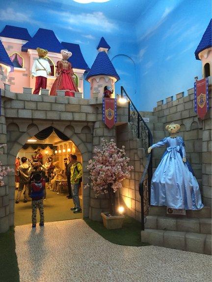
The Teddy Bear Museum in South Korea is located in the Chinese tourist area of Jeju Island. It covers an area of 13,530 square meters and exhibits 1,200 teddy bears. The history museum on the first floor recreates 11 significant events in human history such as the emergence of Ford cars, the sinking of the Titanic, World War II, the moon landing, and the return of Hong Kong, with popular teddy bears appearing in each scene. The art museum on the second floor features the world's most expensive teddy bear dressed in Louis Vuitton fashion, the world's smallest toy bear measuring only 4.5 millimeters, and a teddy bear wedding chapel depicting traditional weddings from around the world. The museum also includes a cafe, bar, souvenir shop, and an outdoor courtyard for photography with teddy bears.
1
km
2
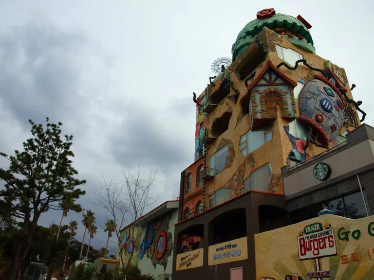
Jeju Island's Ripley's Believe It or Not Museum is one of the world's largest museums, centered around the spirit of explorer Robert Ripley. It is located at the entrance of the Chinese tourism area in Seogwipo City. The museum has 12 art galleries and outdoor parks, souvenir shops, cafes, and other facilities worldwide. It operates 31 chain facilities in countries such as the United States, United Kingdom, Canada, Mexico, and Thailand. The Jeju Island museum is the 32nd venue and the 11th country.
4
km
3
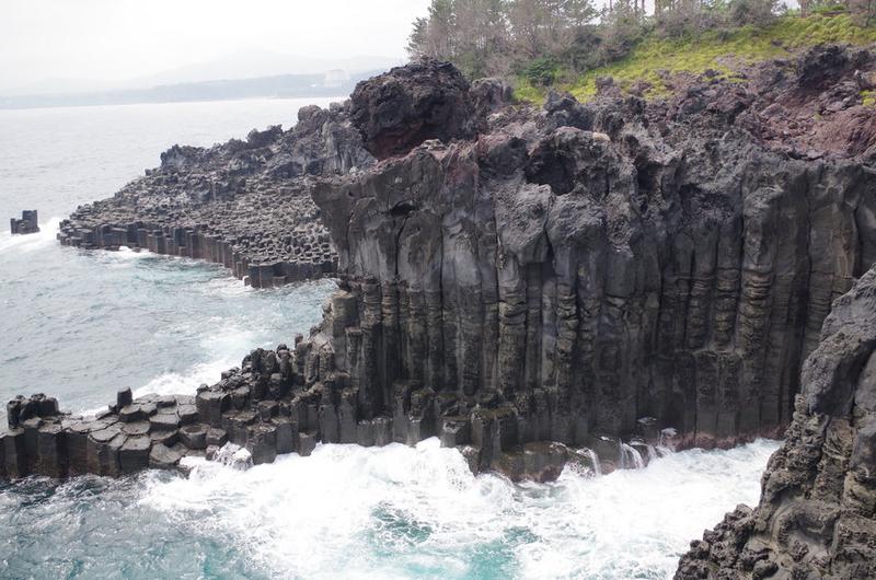
Jusangjeollidae
Columnar Joint Belt is a natural conservation object in Jeju Island. It is a group of hexagonal stone columns of various sizes and heights, formed by the cooling of lava flowing into the sea from Hallasan long ago. It is like a meticulously carved artwork, stunning people.
15
km
4
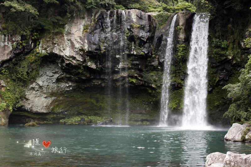
Tian Di Yuan is located deep in the Tian Di Yuan valley, surrounded by temperate forests. The three-tier waterfall cascading down the dense temperate forest is especially spectacular. Legend has it that there are many giant eels inhabiting the bottom of the lake below the waterfall. The Tian Di Yuan waterfall features an arched "Xian Lin Bridge" engraved with beautiful fairies, as well as a pavilion called the "Tian Di Tower," which enhances the beauty of the surrounding landscape.
