The Most Beautiful Highway - Icefield Parkway Self-Drive Tour
4 cities |
21 attraction(s) |
total distance 305
km
 TIPS
TIPS
Day1
Day2
Day3
Day4
Day5
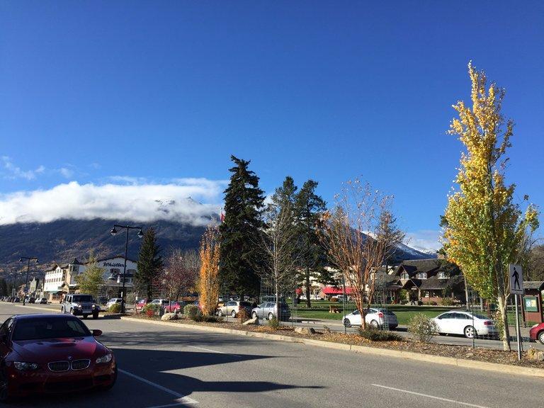
Day1: Calgary
4 attraction(s) ·
56 km
1

Next to Bow River in the city center. Beautiful scenery. Many people walk and exercise in the park every day.
6
km
2
18
km
3

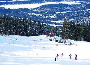
This park covers an area of 95 hectares and was originally built for the 1988 Winter Olympics. It features ski jumping, bobsleigh, freestyle skiing, and Paralympic events. The park now offers a variety of activities throughout the year to attract tourists. With the help of snowmaking machines, Calgary residents can enjoy skiing as early as November. Many national and international sports competitions are held here.
33
km
4
Spruce Meadows is one of the world's top equestrian venues, hosting 15 major show jumping events each year. The world's top athletes gather here to compete for over CAD 6 million in prize money.
Day2: Banff National Park > Banff Town > Banff National Park
4 attraction(s) ·
19 km
1
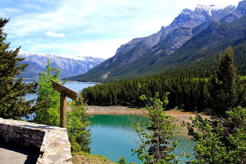
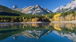
Two Jack Lake, located near Banff Town and adjacent to Lake Minnewanka, has blue-green water and a small island similar to Spirit Island in Maligne Lake, Jasper National Park. In the late 19th century, there were two good friends named Jack in this area. One was Jack Stanley, who operated a small boat business on nearby Lake Minnewanka, and the other was Jack Watters, who worked at the nearby Bankhead coal mine. The two often gathered by the lake here, and that's why people called it Two Jack Lake.
14
km
2
The Banff Centre is a cultural center showcasing artworks and hosting various cultural events in the town of Banff. It is famous for The Banff Centre for Continuing Education.
1
km
3
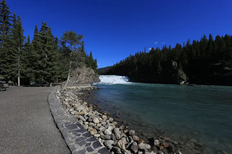
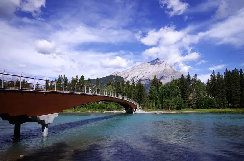
Bow Falls is located on the southeast side of Banff town, below the Banff Springs Hotel. It is the backdrop for Marilyn Monroe's famous film "River of No Return". Despite being a small waterfall with a drop of only about 10 meters, it is characterized by white waves and thunderous sounds. The waterfall is formed by the fault of the Bow River, and it converges here with its tributary, the Spray River, which flows swiftly and rushes downstream. There are walking trails along both sides of the waterfall for hiking, and benches are available for visitors to rest.
6
km
4
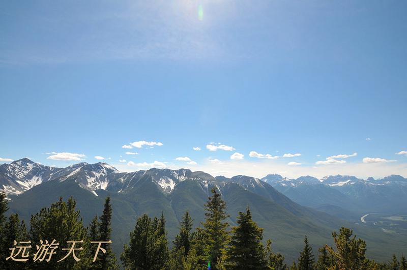
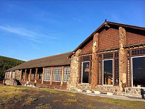
Sulphur Mountain is part of the Canadian Rockies surrounding Banff. Located at an altitude of 2450m, the observatory on the summit is accessible year-round by cable car, allowing visitors to enjoy panoramic views of Banff and the surrounding mountains, rivers, and valleys. Looking north from the town of Banff, the prominent Cascade Mountain stands nearby, with Tunnel Mountain to the right and Mount Rundle further to the right. The castle-like structure in the pine forest is the Fairmont Banff Springs Hotel. Squirrels and bighorn sheep can occasionally be spotted on the summit. Sulphur Mountain is a popular tourist destination throughout the year, and has attracted over ten million visitors, becoming a must-see attraction in Banff.
In 1884, a superintendent of the Canadian Pacific Railway discovered a hot spring at the foothills of Sulphur Mountain. It underwent renovations in 1996 and is now more beautiful than before. Due to the presence of sulphur in the hot spring, the mountain was named Sulphur Mountain. The water temperature ranges from approximately 37 to 40 degrees Celsius, allowing visitors to enjoy soaking in the hot springs while admiring the distant views of Mount Cascade and Mount Norquay.
Day3: Banff National Park
6 attraction(s) ·
150 km
1
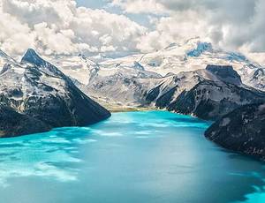
Dream Lake is located within Banff National Park. As a glacial lake, it reaches its peak water level in June each year, displaying a beautiful turquoise color. There are multiple hiking trails for viewing Dream Lake, but due to bear activity, Parks Canada regularly updates trail information and restrictions. The best trail for viewing Dream Lake is the Rockpile Trail.
15
km
2

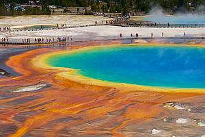
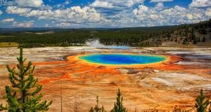
Under the envelopment of dense forests, Lake Louise is like a pristine gem, with a pure and ethereal beauty. It is shielded by the majestic Victoria Mountain, creating a perfect scenery. It is one of the most popular photography destinations in North America. Lake Louise is fed by the Victoria Glacier, its water is clear and emerald green, like a jewel embedded in the Rocky Mountains. The lake's water is extremely cold, and during the period from November to June, it freezes over, creating a beautiful ice skating rink blending seamlessly with the ice and snow of the Victoria Mountain. It takes about a two-hour drive or bus ride from Banff Town, via the Bow Valley Parkway, to reach Lake Louise. Along the way, there are charming views of lakes and mountains, and there are often opportunities to see wildlife foraging by the roadside.
42
km
3
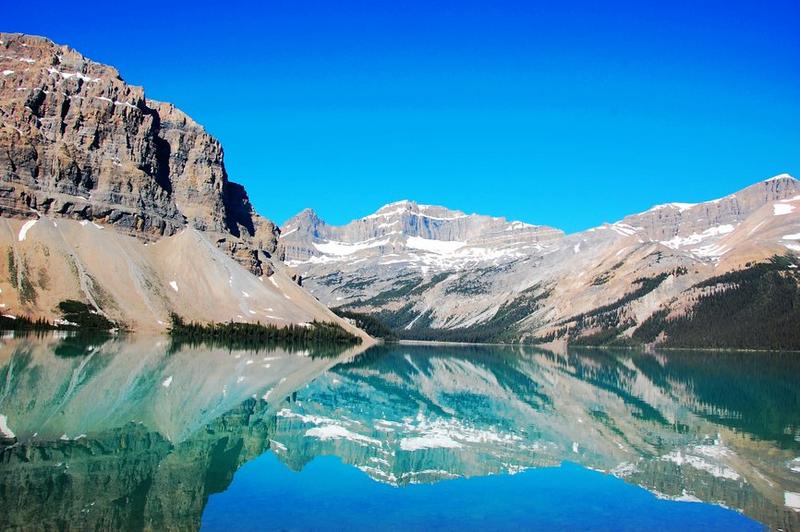
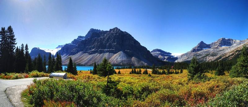
Bow Lake is a glacial lake located in the western part of Alberta, Canada. It is situated on the Bow River of the Rocky Mountains, at an altitude of 1,920 meters. It is south of Bow Peak, east of the Waputik Range, and west of Dolomite Pass. It can be reached via the Icefields Parkway between Banff National Park and Jasper National Park.
8
km
4
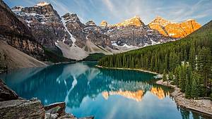
Peyto Lake is a lake located in Banff National Park known for its beautiful scenery. The entire lake surface looks like a blue ribbon embedded in the mountains.
71
km
5
Icefields Parkway, also known as Highway 93, passes through stunning icefields and connects Lake Louise and Jasper, crossing Banff National Park and Jasper National Park. It runs parallel to the Continental Divide and traverses the rugged Rocky Mountains.
16
km
6
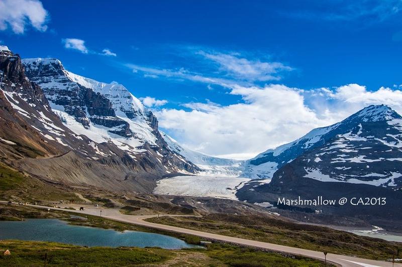
Columbia Icefield is a glacier located between the northwest corner of Banff National Park and Jasper National Park in Canada's Rocky Mountains. It spans the continental divide in North America and covers an area of approximately 325 square kilometers. The Athabasca Glacier, which has noticeably receded since 1844, can be seen from the Icefields Parkway.
The Columbia Icefield encompasses six main glaciers: Athabasca Glacier, Castleguard Glacier, Columbia Glacier, Dome Glacier, Stutfield Glacier, and Saskatchewan Glacier.
Visitors have the option to take helicopter tours for an aerial view or explore the Athabasca Glacier on the specially designed "Ice Explorer" glacier bus.
Day4: Jasper National Park
4 attraction(s) ·
43 km
1
Athabasca Falls is a famous waterfall in Jasper National Park. Despite its height of only over 20 meters, it has a turbulent flow, a large volume of water, and a deafening sound. The canyon it flows through has been eroded by the water year-round, forming unique vertical cliffs.
32
km
2
Jasper Town is the central town of Jasper National Park, with the most comprehensive services including restaurants, hotels, train stations, bus stations, cinemas, and amusement parks. Visitors can go hiking and boating during the day and return to the town for rest in the evening. The town is clean and quiet, and most importantly, the Canadian Pacific Railway passes through here, making it a transportation hub.
8
km
3
Pyramid Lake is located within Jasper National Park in Alberta, Canada, at the foot of the Pyramid Mountains. It is named after this mountain range. There are picnic spots and hotel accommodations available near the lake. Pyramid Lake connects to some hiking trails in Jasper National Park and the town of Jasper.
4
km
4
Patricia Lake is located in Jasper National Park, Alberta, Canada. Its name comes from Princess Patricia of Connaught, the granddaughter of Queen Victoria. It is situated 5 kilometers north of the town of Jasper. The lake is most famous for being the experimental site of the second phase of Project Habbakuk during World War II. The project aimed to construct an aircraft carrier using a mixture of wood pulp and ice in order to combat German submarines. However, due to disagreements and flaws, the project was terminated in 1943.
Day5: Jasper National Park
3 attraction(s) ·
38 km
1
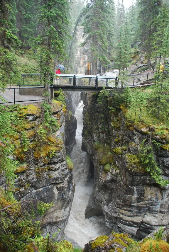
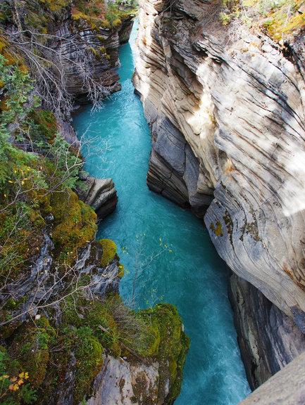
This is a typical karst landform. The Malin River, which flows out of the Malin Lake upstream, passes through here and cuts a roughly 2-kilometer long, winding and deep canyon on the limestone. The canyon is flanked by mostly vertical cliffs, and is only a few meters wide at narrow points. Due to the large drop and fast-flowing water, there are more than ten waterfalls, and the entire valley is filled with the roaring sound of water, which is quite thrilling. The Malin Canyon is filled with numerous waterfalls, showcasing its typical karst topography. There is an introduction to the formation of karst landforms at the entrance. It is a must-visit place in Jasper National Park.
16
km
2
This lake is located on the way from Jasper Town to Maligne Lake. Its unique name is derived from a magical natural phenomenon - the water level of the lake is normal in spring and summer, but gradually starts to disappear around October each year, with a total annual water level change of up to 20 meters. Local indigenous people have difficulty explaining this phenomenon and believe it is caused by magical powers, hence the name Witch Medicine Lake. This phenomenon is due to the influence of an underground river system on the water level of Witch Medicine Lake: the glacial meltwater fills the lake in spring and summer; in autumn, the amount of snowmelt on the mountain decreases, and the water level starts to decline until it completely dries up in winter, disappearing entirely; then in the following spring and summer, the lake water returns as scheduled, and the cycle continues.
23
km
3
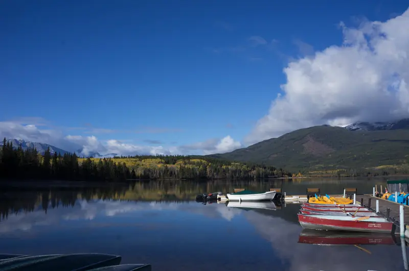
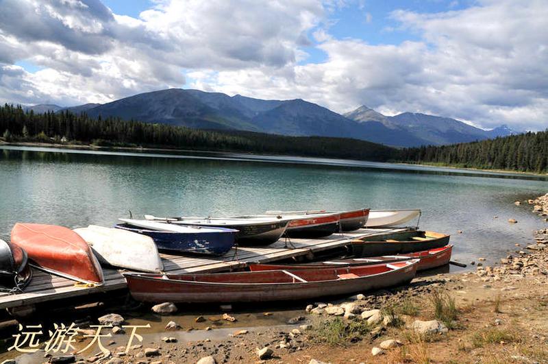
Jasper National Park has the largest natural lake, which is 22 kilometers long, 1 kilometer wide, and 96 meters deep. The park offers boat tours and water recreation activities, as well as several hiking trails around the lake. Taking a yacht on Maligne Lake is a delightful experience, with picturesque scenery of snow-capped mountains and calm, turquoise waters reflecting the white clouds and peaks against the deep blue sky. The famous Spirit Island in the center of the lake became renowned after a photographer won first prize in a photography contest with their stunning photos of the island, for which they camped on the shore for several days.