12-Day Dream Journey Across New Zealand
9 cities |
32 attraction(s) |
total distance 2871
km
 TIPS
TIPS
Day1
Day2
Day3
Day4
Day5
Day6
Day7
Day8
Day9
Day10
Day11
Day12
Day1: Auckland
2 attraction(s) ·
7 km
1
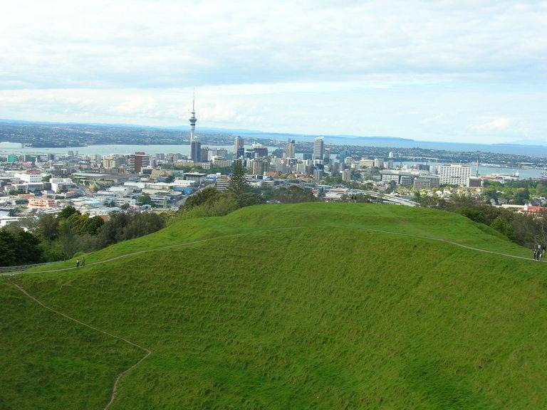
Mount Eden, located in Auckland, is one of the hills formed by volcanic ejecta around a volcanic vent, and it is also the highest point of natural beauty in Auckland, which is stunning. The bottom of the volcanic cone is now a lush green space, which looks like a big cone-shaped bowl from afar, and the unique landscape is unforgettable. Climbing to the top of the mountain, you can enjoy a perfect panoramic view of Auckland, including the beautiful Sky Tower, the spectacular One Tree Hill, and the mysterious Rangitoto Island volcano. In addition to being able to enjoy these wonderful views for free, it is also very suitable for taking photos, capturing panoramic views of the surrounding area, especially when shooting the Sky Tower, it is incomparable.
7
km
Day2: Rotorua
2 attraction(s) ·
7 km
1
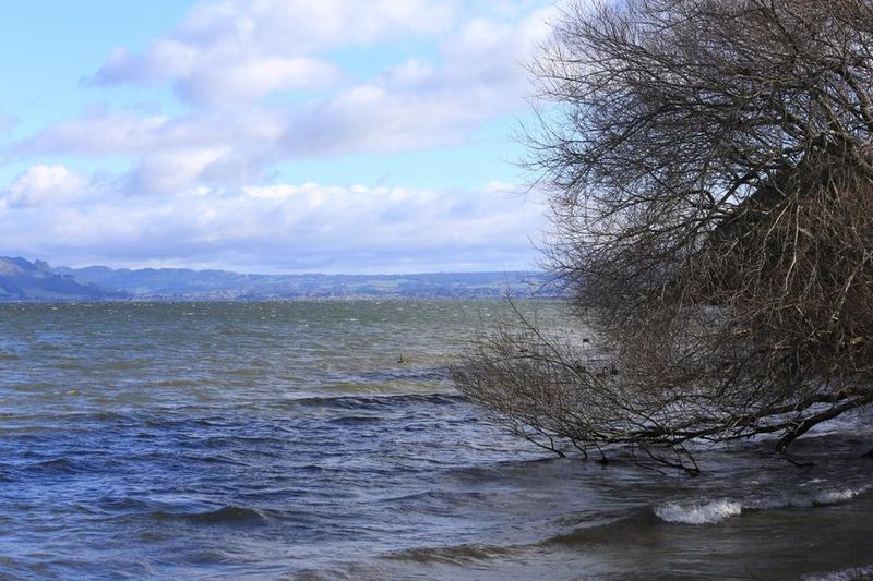
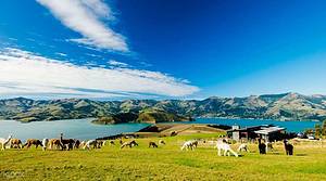
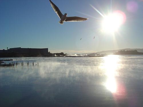
Lake Rotorua is one of the largest lakes in central northern New Zealand's North Island and is one of the leading lakes within approximately 20 lakes. It covers an area of 80 square kilometers (31 square miles) and is a fascinating scenic spot. Located on the edges of the city, Lake Rotorua is a visual feast where you can choose to cruise around the small islands in the lake. For the best views, it's recommended to visit Grand Vue Rd, Kawaha Point, or Rotorua 3010, which are excellent locations for viewing the magnificent scenery of Lake Rotorua.
7
km
2
Polynesia Spa is located in the government garden. It is a historical mineral spring and can be reached within a 5-minute walk from the center of Rotorua. There are a total of 35 hot spring pools here, and visitors can also buy a variety of hot spring derived products. Among them, the mineral mud beauty and skincare products are very famous.
Day3: Rotorua
2 attraction(s) ·
7 km
1
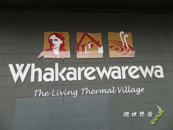
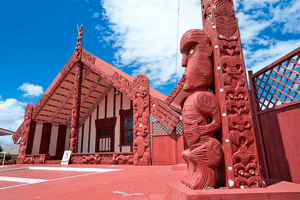
Whakarewarewa Thermal Village is a popular attraction where visitors can observe Maori traditional culture, admire the beautiful hot springs, and watch the breeding of kiwi birds.
7
km
2
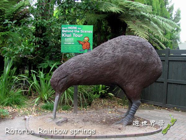
Rainbow Springs Nature Park was established in 1932 and covers 135 acres of lush forest. Visitors can enjoy natural, crystal clear springs in the vicinity. Tickets are valid for a whole day, allowing multiple entries, and even night entry. Those who are tired of daytime activities can enjoy a night tour, especially the Big Splash water slide. The park is an ideal place to observe native New Zealand plants such as kauri and ferns, as well as other plants. Visitors can also see various native New Zealand birds such as kea, kaka, honeyeaters, weka, and rainbow trout. They can also observe tuatara, the only living species of reptiles known to have survived since the dinosaur era, and nocturnal animals' performances both day and night.
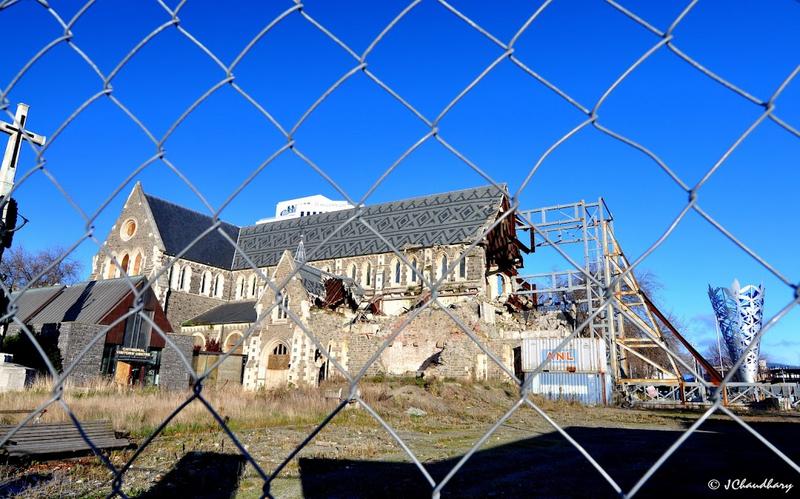
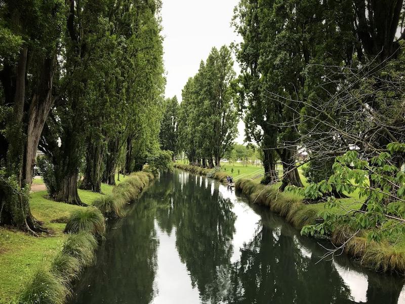
Day4: Christchurch
2 attraction(s) ·
4 km
Day5: Lake Tekapo
3 attraction(s) ·
4 km
1
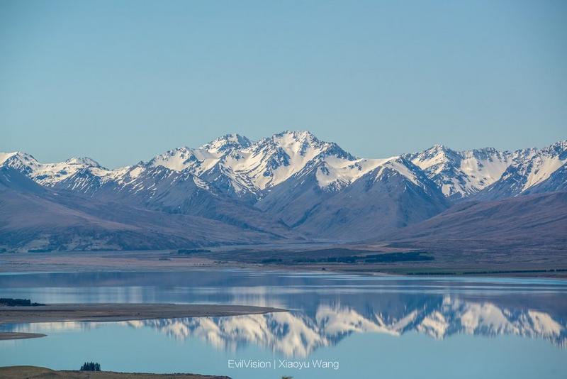
There is a lake called Lake Tekapo in the central part of South Island, New Zealand, managed by Canterbury. The lake is 27 kilometers long, 6 kilometers wide, with an area of 87 square kilometers and an elevation of 700 meters. The average depth of the lake is 69 meters, with a maximum depth of 120 meters. It has strong evaporation capacity and a storage capacity of 6 cubic kilometers.
2
km
2
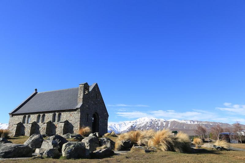
The Church of the Good Shepherd is a historic church constructed by renowned architect Benjamin Woolfield Mountford in 1935. This church features a unique Gothic wood and stone building and is the only one of its kind in New Zealand. It is located on the shores of Lake Tekapo and surrounded by stunning natural scenery amidst towering mountains. Due to its unique architecture and charming environment, many couples choose to hold their weddings here, making it one of the most famous tourist attractions in New Zealand.
3
km
3
John's Mountain Observatory is renowned for its stunning scenery and convenient location. It's just a 15-minute drive from Lake Tikapoo, making it an ideal spot for stargazing.
Day6: South Island > Mount Cook Village
4 attraction(s) ·
63 km

2
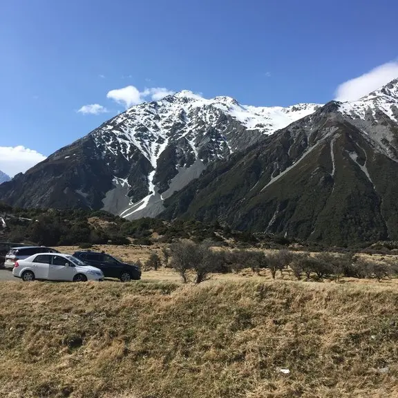
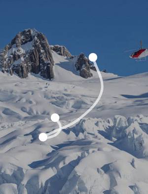
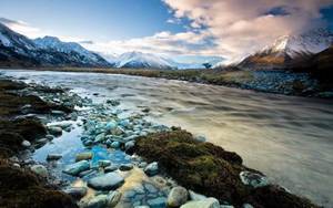
The Cook Islands National Park is located in the southeast of the South Alps, New Zealand. It is one of New Zealand's most famous and oldest national parks, adjacent to the West District National Park, the Aspyling Mountain National Park, and the Fjord National Park. There are nearly 20 mountains here that are over 3,000 meters high, including New Zealand's highest peak - Mount Cook, with an altitude of 3,753 meters. In addition, there are more than 360 magnificent glaciers here, the longest of which is the Tasman Glacier, which is up to 27 kilometers long. If you are passionate about outdoor activities such as climbing, skiing, mountaineering, hiking, and river rafting, the Cook Islands National Park will be a perfect destination. However, if you just want to appreciate the wonderful natural scenery or experience the peaceful environment, visiting this national park is also an unmissable opportunity.
21
km
4
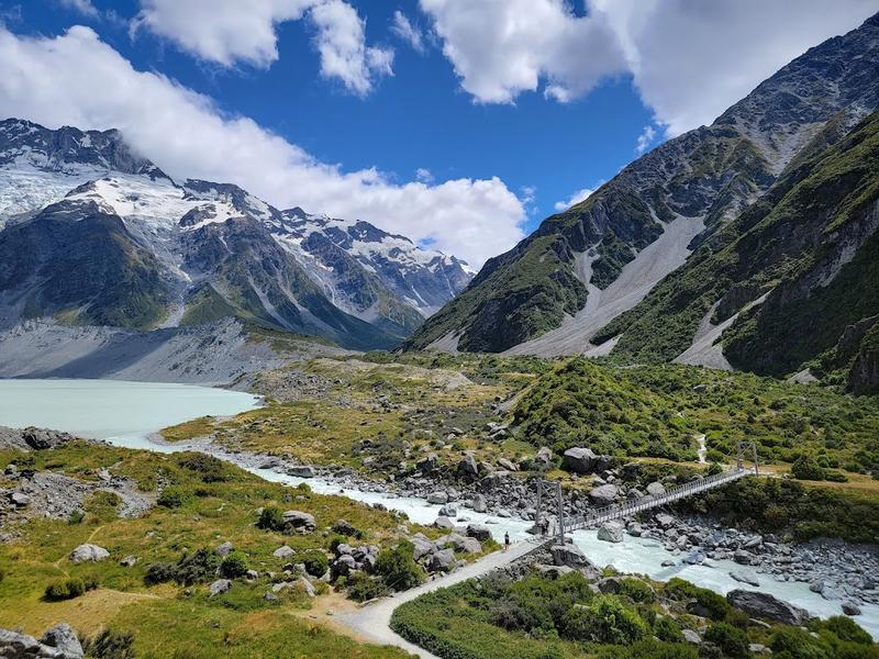
This 5-km. walking track in Mount Cook National Park leads to Hooker Lake & offers sweeping views.
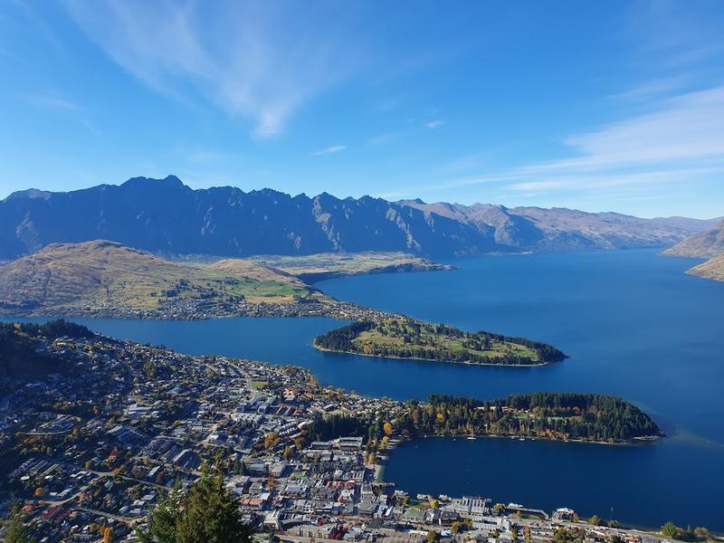
Day7: Queenstown
5 attraction(s) ·
7 km
2

Lush, lakefront peninsula with a waterfront trail & alpine vistas, plus an ice rink & skate ramps.
2
km
3
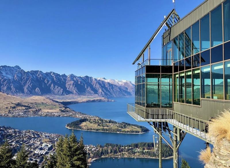
Attraction featuring a gondola to a panoramic restaurant/bar, hiking trails & a luge ride down.
3
km
4
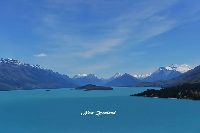
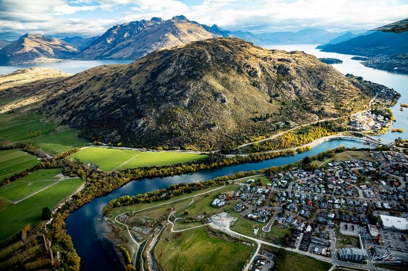
Nestled in a glaciated valley, New Zealand's third largest lake is shaped like a lightning bolt and boasts stunning scenery. The northern end is where the Dart River merges into it, while the Kawarau River flows into the lake mouth after originating from Queenstown. It is surrounded by high mountains, with the highest peak being Mount Earnslaw at 2,819 meters above sea level. The towns around the lake include Queenstown, Kingston, Glenorchy, and Kinloch, the center of New Zealand's outdoor activities. Bungee jumping, a worldwide sensation, originated here. One of the activities by the lake is a cruise on the historic TSS Earnslaw steamship to see the lake views. In the early 20th century, the Earnslaw mainly provided transportation for goods to the ranches on the lake shore. Today, it is still well-preserved and takes tourists to the Walter Peak sheep farm for a stunning view. All of these towns quietly nestled along the lake are worth a visit.
3
km
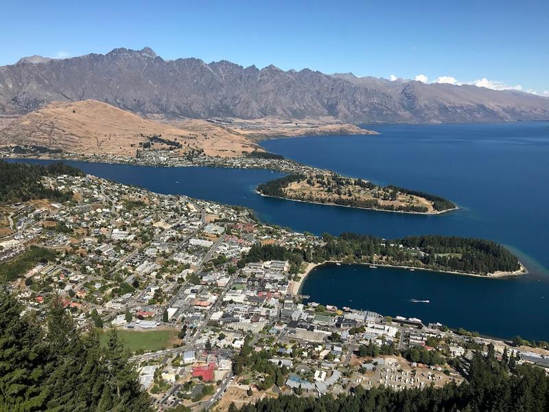
Day8: Queenstown
3 attraction(s) ·
2 km
1
Nestled in a glaciated valley, New Zealand's third largest lake is shaped like a lightning bolt and boasts stunning scenery. The northern end is where the Dart River merges into it, while the Kawarau River flows into the lake mouth after originating from Queenstown. It is surrounded by high mountains, with the highest peak being Mount Earnslaw at 2,819 meters above sea level. The towns around the lake include Queenstown, Kingston, Glenorchy, and Kinloch, the center of New Zealand's outdoor activities. Bungee jumping, a worldwide sensation, originated here. One of the activities by the lake is a cruise on the historic TSS Earnslaw steamship to see the lake views. In the early 20th century, the Earnslaw mainly provided transportation for goods to the ranches on the lake shore. Today, it is still well-preserved and takes tourists to the Walter Peak sheep farm for a stunning view. All of these towns quietly nestled along the lake are worth a visit.
2
km

3
Day9: South Island > Te Anau
4 attraction(s) ·
122 km
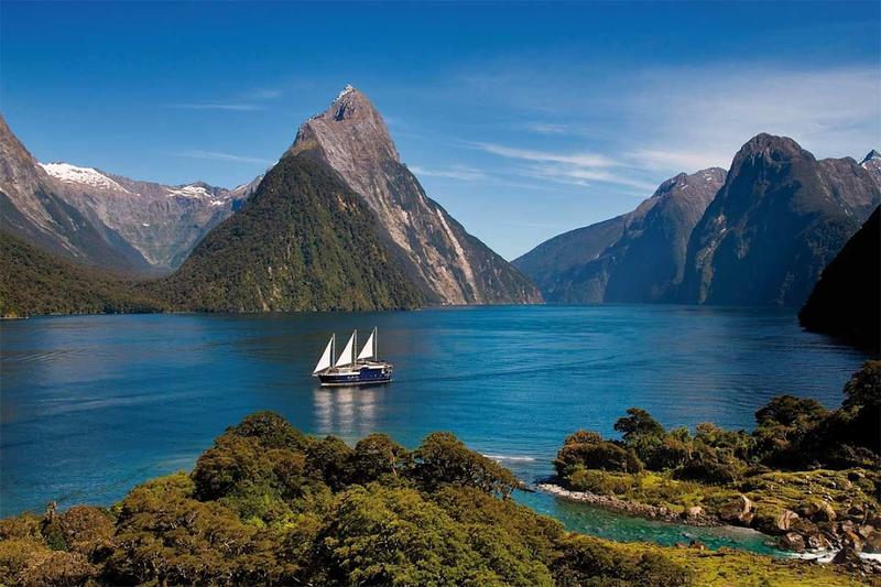
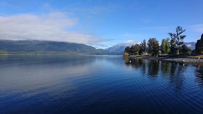
3
Lake Te Anau is a famous lake in the Fiordland National Park in the southwest of the South Island of New Zealand, and is the second largest lake in the country after Lake Taupo. The lake is 55 kilometers long, covers an area of 344 square kilometers, and has an altitude of 210 meters. Lake Te Anau is also one of the largest glacier lakes in the southern hemisphere, with three huge fjords extending westward along its north-south axis, namely the North, Middle and South fjords. In addition, the lake has many small bays and estuaries. The maximum depth of Lake Te Anau is 417 meters, and the Waiau River originates here. The lake also breeds salmon and sturgeon, and is a popular tourist attraction.
18
km
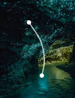
4

Discovered in 1948, this cave system is a popular tourist attraction because of its glow worms.
Day10: Dunedin
2 attraction(s) ·
2 km
1
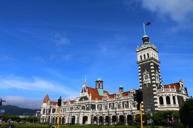
This British railway station is steeped in history, with exhibitions inside and tourists able to take trains to the nearby coastal peninsula.
2
km
2
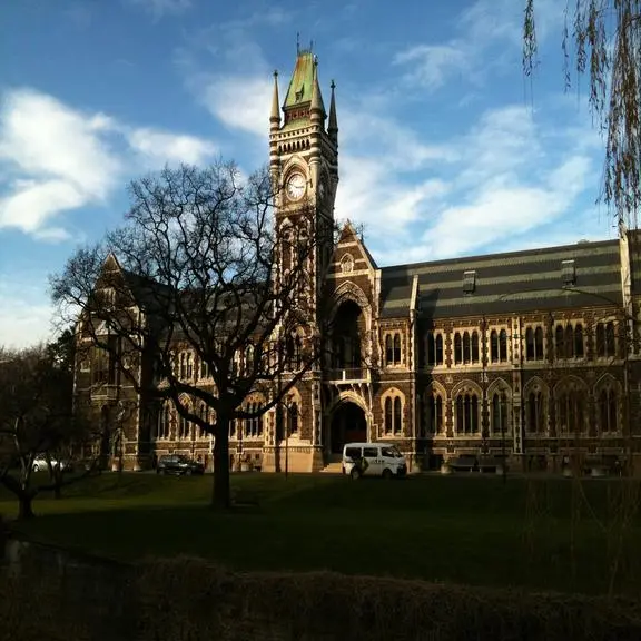
This university, founded in 1869, is one of the oldest in New Zealand. The clock tower at the Registrar's office is an iconic building in Dunedin, with its architecture modeled after the main building at the University of Glasgow. The use of dark basalt and light Oamaru stone creates a strong color contrast. The university is open to visitors and guided tours are available to showcase its beautiful campus and rich history.
Day11: Dunedin
2 attraction(s) ·
17 km
1
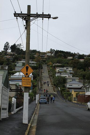
Every visitor to Dunedin will head to this residential street with a slope of about 19 degrees. For drivers with strong skills and responsive brakes, they can speed down the slope at the top like on a rollercoaster. However, most visitors choose to hike up and take interesting photos on the way. In February, the Gutbuster race is held here and in July, the Cadbury World chocolate factory rolls down 10,000 chocolate candies from the top of the slope for visitors to enjoy for free - both fun and delicious.
17
km
2
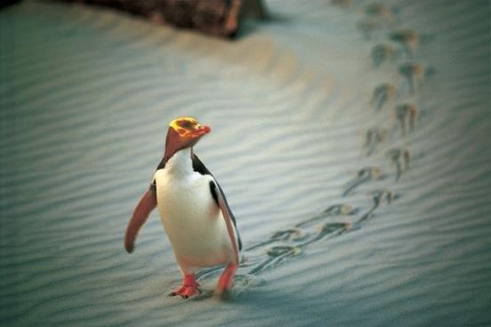
"Penguin Place" is a privately funded sanctuary aimed at saving the rare species, Yellow-Eyed Penguin, from global extinction. This adorable tailcoat gentleman is currently only found in natural reserves within New Zealand, with only around 5,000-6,000 in existence. Visitors are recommended to travel to Dunedin and join a local tour to Penguin Place to observe and admire these lovely creatures. The entire trip takes about 2 hours, and visitors can get up close and personal with the penguins using a unique hidden system and concealed tunnels. The best time to observe Yellow-Eyed Penguins is from 3pm until before dark.
Day12: Dunedin > Auckland
2 attraction(s) ·
1064 km