10-Day Southwest Adventure
11 cities |
22 attraction(s) |
total distance 4250
km
 TIPS
TIPS
Day1
Day2
Day3
Day4
Day5
Day6
Day7
Day8
Day9
Day10
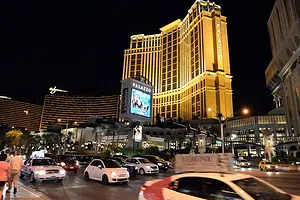
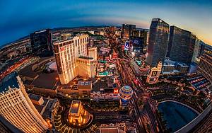
Day1: Las Vegas > Paradise > Las Vegas
4 attraction(s) ·
8 km
1
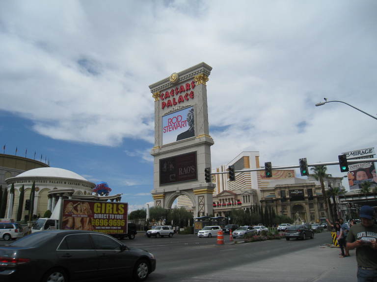
Las Vegas Boulevard is a major road in the Las Vegas Valley area of Nevada, with a length of 82.7 kilometers. The southern section of the road is known for its dense concentration of casinos and hotels, and is known as "the Strip." Once a part of U.S. Route 91 in Nevada, the highway was an important route linking Los Angeles and Salt Lake City. However, it was later replaced by the new Interstate 15, and now Las Vegas Boulevard mainly handles local traffic, with some sections being part of Nevada State Route 604.
1
km
2
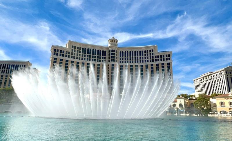
Soaring, iconic fountains featuring dramatic aquatic shows choreographed with music & lights.
1
km
3
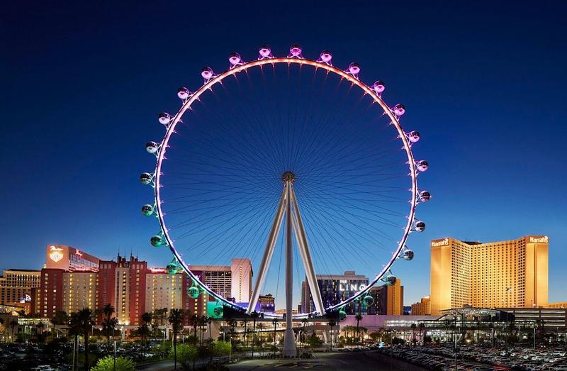
This 550-foot-tall Ferris wheel with observation cabins offers city views & holds up to 40 people.
7
km
4
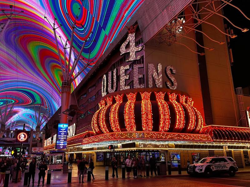
Sprawling 24-hour mall featuring a huge LED canopy, casino & restaurant access, plus entertainment.
Day2: St George
2 attraction(s) ·
1 km
1

Originally a church & courthouse, this traditional structure is now available for public events.
1
km
2

Restored 19th-century home of Mormon pioneer Brigham Young, featuring period furnishings & art.
Day3: St George > Washington County > Tooele County
3 attraction(s) ·
390 km


Day4: Garfield County > Juab County > Salt Lake City
3 attraction(s) ·
408 km
1
Vast camping & hiking locale with diverse terrain such as domes, cliffs & a 100-mile-long monocline.
268
km
3
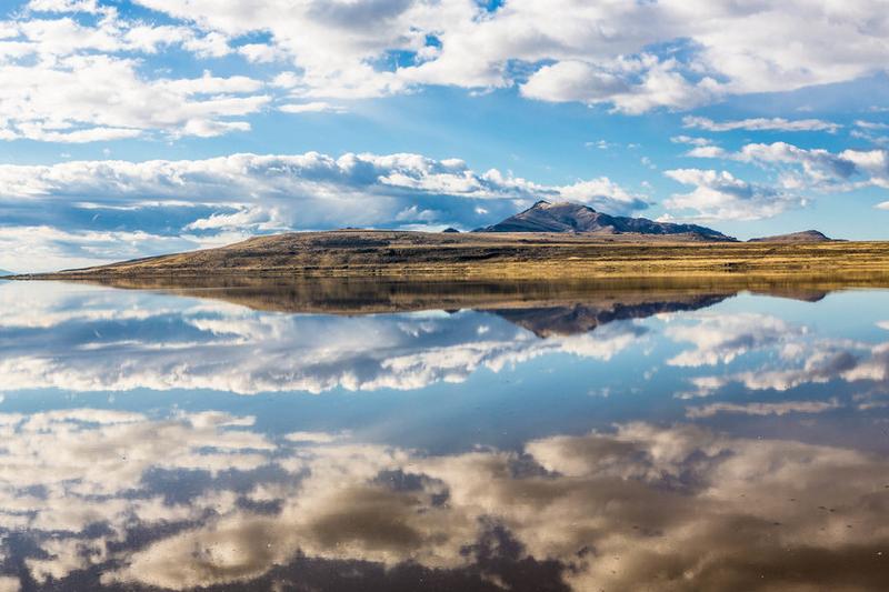
The Great Salt Lake is a salty lake consisting of 10 small islands, covering an area of approximately 20,000 square miles. It is the second saltiest lake in the world. The Great Salt Lake is also an important wildlife sanctuary, attracting millions of migratory birds to feed and nest every year. Additionally, the Bonneville Salt Flats, located in the Great Salt Lake region, are ideal for racing cars, airplanes, and even spacecraft landings due to their flat terrain. This was also the location used in the movie "Need for Speed" as the gathering place for racing teams after their cars were lifted from a cliff. In the past, the Bonneville Salt Flats have dried up, becoming a famous tourist destination.
Day5: Salt Lake City
3 attraction(s) ·
7 km

2

Built in 1916, the renovated neoclassical revival building offers original murals, exhibits & tours.
6
km
3

The various exhibits displayed here are rich and colorful, covering various fields from astronomy to geography, from animals to biology, and so on. Taking a stroll here will broaden your horizon and enable you to learn more extensive knowledge, not just limited to what's in books.
Day6: Tooele County > Moab
3 attraction(s) ·
326 km
2
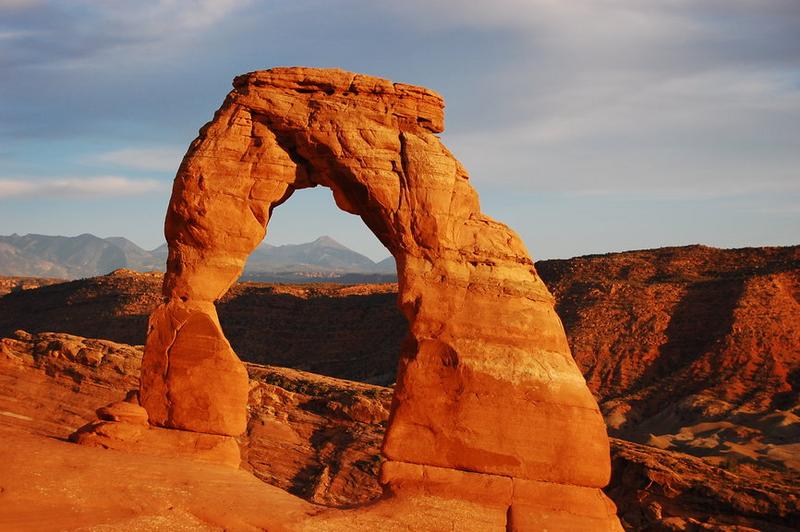
Arches National Park, located near Moab, Utah, USA, covers an area of 309 square kilometers and preserves over 2,000 natural rock arches, including the world-famous delicate arch. The highest point in the park is Elephants Butte at an elevation of 1,753 meters. The park attracts around 850,000 visitors annually, with some coming to study geology or the evolution of nature. Most visitors, however, come to see the renowned arches and share their experiences with others. Regardless of the reason, the park's grandeur and research value are widely recognized.
9
km
3
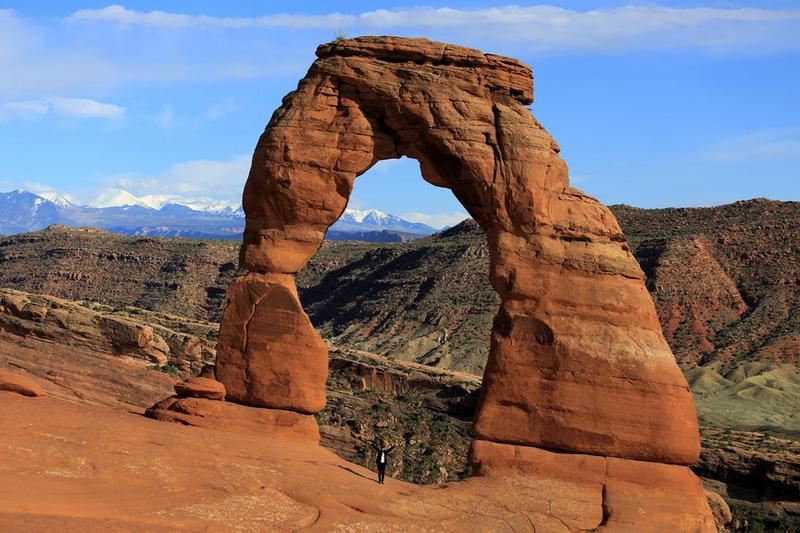
Arches National Park is a stunning park, with its most iconic, beautiful and famous site being the Arches. This Arches is even featured on the license plates in Utah. If you come here, you definitely cannot miss it. There are two options to see the Arch, depending on your time and physical ability: the Delicate Arch Trail and the Delicate Arch Viewpoint. You can admire the beauty of the Arch up close or from afar, experiencing different perspectives. As the sunlight changes, the colors of the Arch also change, especially when combined with the texture of the rocks and the distant La Sal Mountains, making this natural masterpiece endlessly charming and truly awe-inspiring.
Day7: Tooele County
1 attraction(s) ·
0 km
1
Day8: Tooele County > Navajo County
2 attraction(s) ·
427 km

Day9: Tooele County > Navajo County > Page
5 attraction(s) ·
568 km
5
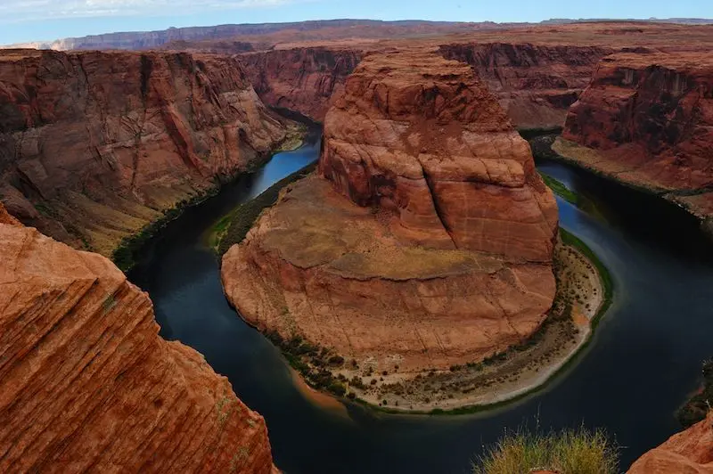
Horseshoe Bend, located in Page, Arizona, is a horseshoe-shaped river bend situated below the Glen Canyon Dam and Lake Powell, only 6 kilometers from the city of Page. It can be reached by walking 1.2 kilometers from US Highway 89. The best viewpoint is located on a steep cliff, 4,200 feet above the river and 3,200 feet above sea level, with a drop of 1,000 feet. To witness the magnificent beauty of Horseshoe Bend, visiting this place is recommended to appreciate the wonders and charms of nature.
Day10: Tooele County > Page
2 attraction(s) ·
375 km
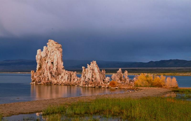
2
Lake Powell was named after John Powell, a pioneering American who was the first to raft down the river and make recommendations for water development. It is a natural body of water with an area that is twice the size of Lake Mead. The area surrounding the lake features a variety of natural landscapes, including red sandstone, arches, canyons, and sparkling lakes, making it a beautiful and spectacular holiday destination in the southwestern United States. The construction of Lake Powell began in 1956 while the Glen Canyon Dam was under construction. It wasn't until 1980 that the water from the Colorado and San Juan Rivers and the Escalante River was diverted to the lake, making it complete in its true sense. The final scene of the movie Gravity was filmed at Lake Powell, but most of the scenery near the lake was actually computer-generated and differs greatly from the surrounding desert landscape.