South Island Nature Tour
10 cities |
33 attraction(s) |
total distance 1485
km
 TIPS
TIPS
Day1
Day2
Day3
Day4
Day5
Day6
Day7
Day8
Day9
Day10
Day1: Christchurch
3 attraction(s) ·
4 km
1
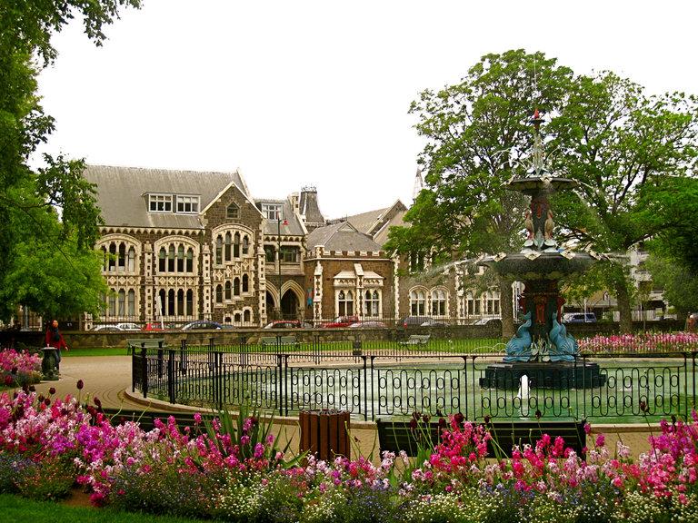
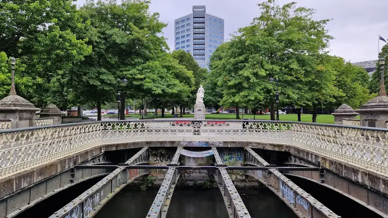
Christchurch has a 300,000 square meter green land located by the Avon River, which is the most pleasant place in the city. Over ten thousand species of plants display a colorful array of colors in different seasons, bringing endless surprises to visitors. Whether it's the elderly, children, couples, or friends, taking a stroll in the botanical garden or enjoying a cup of coffee in the cafe is very pleasant. The visitor information center is located between the botanical garden and the Canterbury Museum and provides timely answers to any visitor questions. Come here and experience the atmosphere of the garden city!
1
km
2
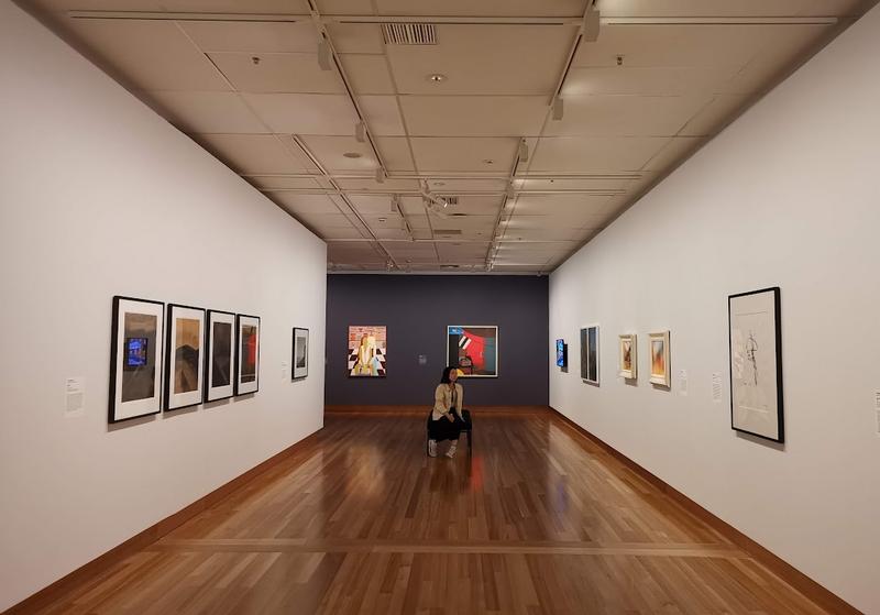
Art museum showcasing contemporary works & offering films, lectures, tours & family events.
4
km
Day2: Lake Tekapo
3 attraction(s) ·
4 km
1
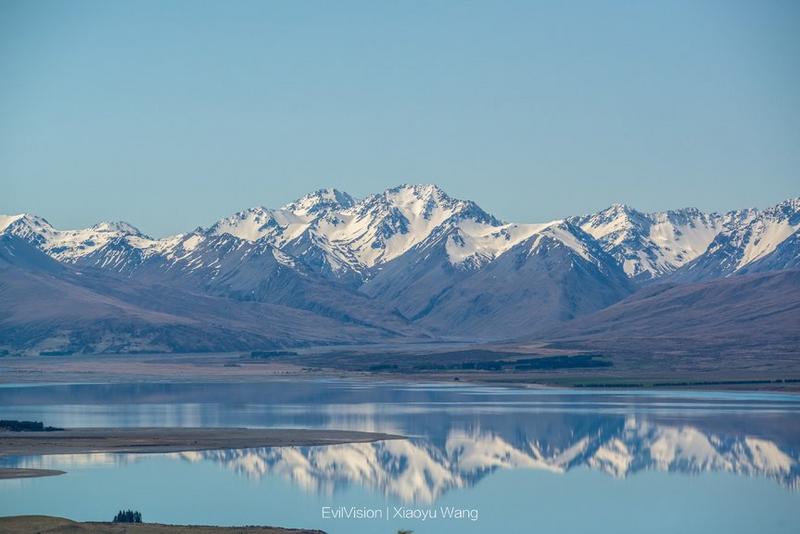
There is a lake called Lake Tekapo in the central part of South Island, New Zealand, managed by Canterbury. The lake is 27 kilometers long, 6 kilometers wide, with an area of 87 square kilometers and an elevation of 700 meters. The average depth of the lake is 69 meters, with a maximum depth of 120 meters. It has strong evaporation capacity and a storage capacity of 6 cubic kilometers.
2
km
2
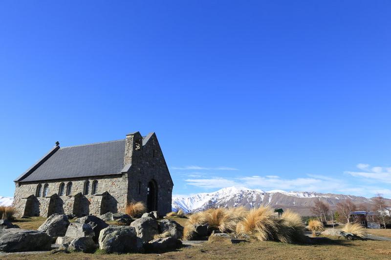
The Church of the Good Shepherd is a historic church constructed by renowned architect Benjamin Woolfield Mountford in 1935. This church features a unique Gothic wood and stone building and is the only one of its kind in New Zealand. It is located on the shores of Lake Tekapo and surrounded by stunning natural scenery amidst towering mountains. Due to its unique architecture and charming environment, many couples choose to hold their weddings here, making it one of the most famous tourist attractions in New Zealand.
3
km
3
John's Mountain Observatory is renowned for its stunning scenery and convenient location. It's just a 15-minute drive from Lake Tikapoo, making it an ideal spot for stargazing.
Day3: South Island > Mount Cook Village
4 attraction(s) ·
80 km

3
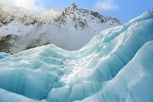
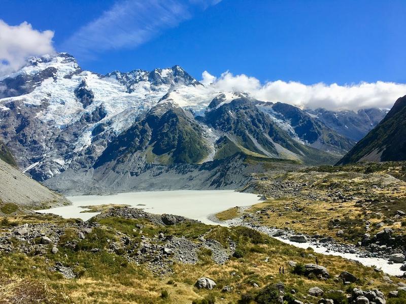
The Cook Islands National Park is located in the southeast of the South Alps, New Zealand. It is one of New Zealand's most famous and oldest national parks, adjacent to the West District National Park, the Aspyling Mountain National Park, and the Fjord National Park. There are nearly 20 mountains here that are over 3,000 meters high, including New Zealand's highest peak - Mount Cook, with an altitude of 3,753 meters. In addition, there are more than 360 magnificent glaciers here, the longest of which is the Tasman Glacier, which is up to 27 kilometers long. If you are passionate about outdoor activities such as climbing, skiing, mountaineering, hiking, and river rafting, the Cook Islands National Park will be a perfect destination. However, if you just want to appreciate the wonderful natural scenery or experience the peaceful environment, visiting this national park is also an unmissable opportunity.
20
km
4
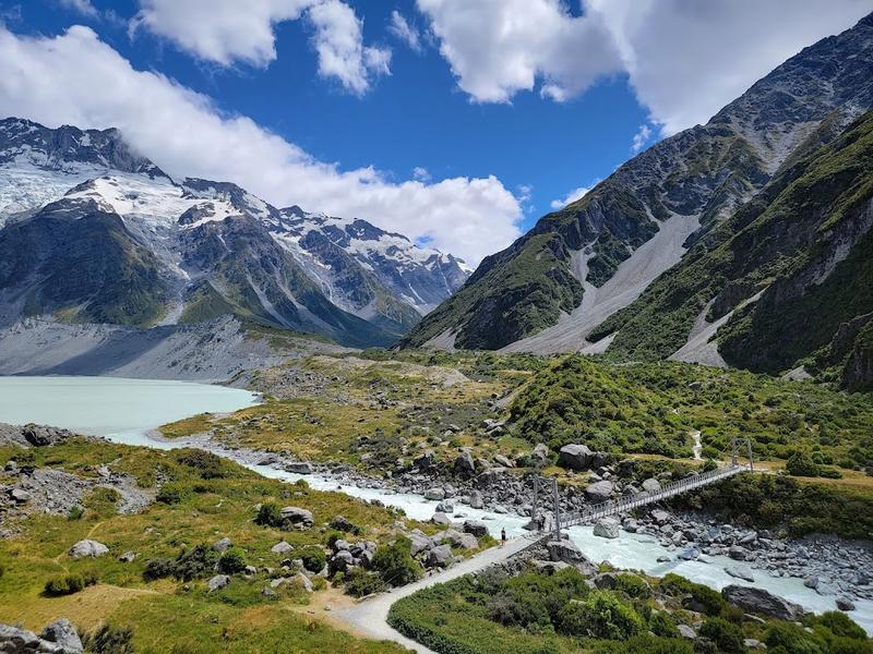
This 5-km. walking track in Mount Cook National Park leads to Hooker Lake & offers sweeping views.
Day4: Mount Cook Village > Queenstown
4 attraction(s) ·
187 km
3
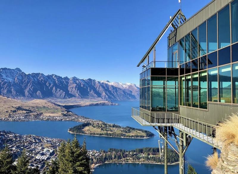
Attraction featuring a gondola to a panoramic restaurant/bar, hiking trails & a luge ride down.
3
km
4
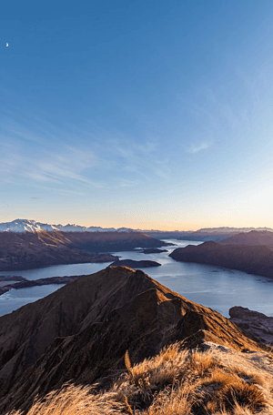
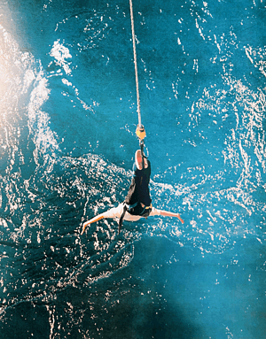
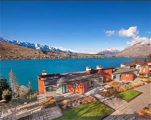
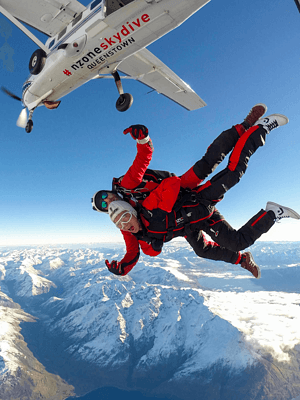
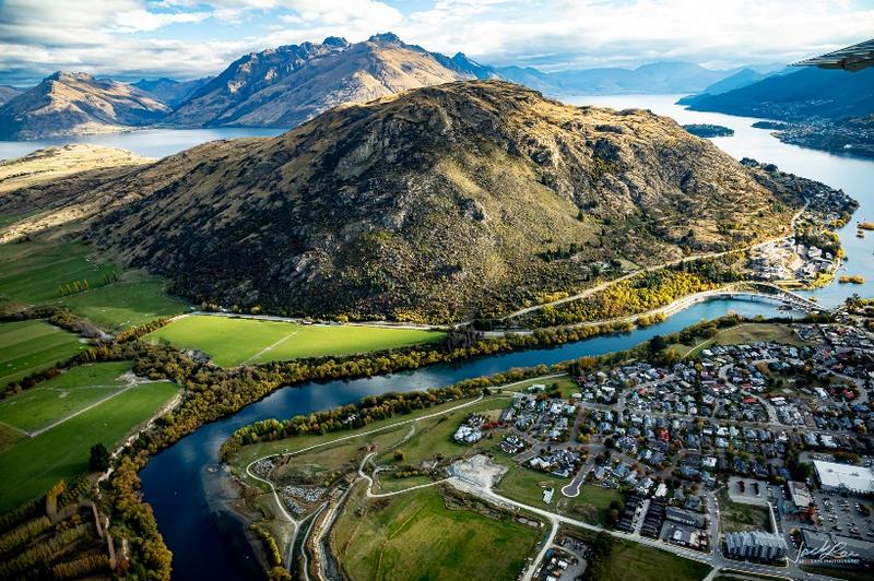
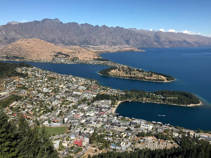
Nestled in a glaciated valley, New Zealand's third largest lake is shaped like a lightning bolt and boasts stunning scenery. The northern end is where the Dart River merges into it, while the Kawarau River flows into the lake mouth after originating from Queenstown. It is surrounded by high mountains, with the highest peak being Mount Earnslaw at 2,819 meters above sea level. The towns around the lake include Queenstown, Kingston, Glenorchy, and Kinloch, the center of New Zealand's outdoor activities. Bungee jumping, a worldwide sensation, originated here. One of the activities by the lake is a cruise on the historic TSS Earnslaw steamship to see the lake views. In the early 20th century, the Earnslaw mainly provided transportation for goods to the ranches on the lake shore. Today, it is still well-preserved and takes tourists to the Walter Peak sheep farm for a stunning view. All of these towns quietly nestled along the lake are worth a visit.
Day5: Queenstown > Arrowtown
3 attraction(s) ·
34 km
1

Lush, lakefront peninsula with a waterfront trail & alpine vistas, plus an ice rink & skate ramps.
17
km
3
Day6: South Island
3 attraction(s) ·
57 km
Day7: South Island > Te Anau
4 attraction(s) ·
122 km
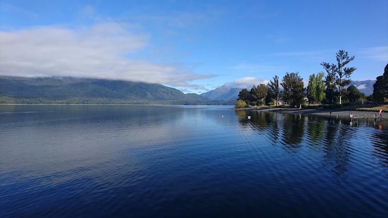
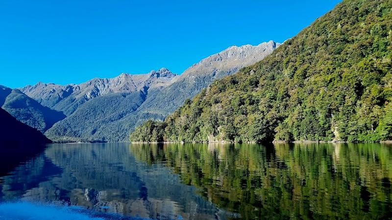
3
Lake Te Anau is a famous lake in the Fiordland National Park in the southwest of the South Island of New Zealand, and is the second largest lake in the country after Lake Taupo. The lake is 55 kilometers long, covers an area of 344 square kilometers, and has an altitude of 210 meters. Lake Te Anau is also one of the largest glacier lakes in the southern hemisphere, with three huge fjords extending westward along its north-south axis, namely the North, Middle and South fjords. In addition, the lake has many small bays and estuaries. The maximum depth of Lake Te Anau is 417 meters, and the Waiau River originates here. The lake also breeds salmon and sturgeon, and is a popular tourist attraction.
18
km
4

Discovered in 1948, this cave system is a popular tourist attraction because of its glow worms.
Day8: Invercargill > South Island > Bluff
5 attraction(s) ·
47 km
3
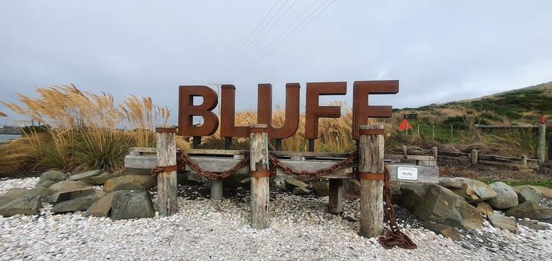
The true meaning of the English word "BLUFF" is "the end of the earth", and on the map of the South Island, this small place is the last one of the South Island. The town of Bluff is located on this narrow piece of land. There is a yellow road sign standing by the roadside indicating the direction and distance to major cities around the world.
3
km
4

The Bluff Maritime Museum is a place that documents the valuable history of the southernmost town in New Zealand, specifically the history of whaling, the construction of harbors, and navigation. The museum allows visitors to learn about the history and culture of Bluff and provides information on important events in the area. It is a collective effort to protect the historical heritage and culture of Bluff. One of the museum's significant collections is the whaling ship Monica, which began service in Bluff Harbor in 1937 and is now docked next to the museum. In addition to whaling, the museum also showcases historical materials on mining coal and building wharves. Furthermore, the Bluff Maritime Museum displays maritime equipment and artifacts to further educate visitors about Bluff's maritime history. For visitors interested in New Zealand history and culture, the Bluff Maritime Museum is a must-visit destination.
22
km
Day9: Dunedin
4 attraction(s) ·
42 km
2
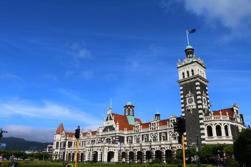
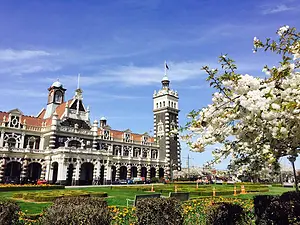
This British railway station is steeped in history, with exhibitions inside and tourists able to take trains to the nearby coastal peninsula.
21
km
3
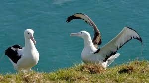
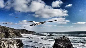
The Royal Albatross Centre, located by the sea, is a wildlife sanctuary where visitors can enjoy watching numerous albatrosses.
21
km
4
Day10: Dunedin > Christchurch
2 attraction(s) ·
309 km
1
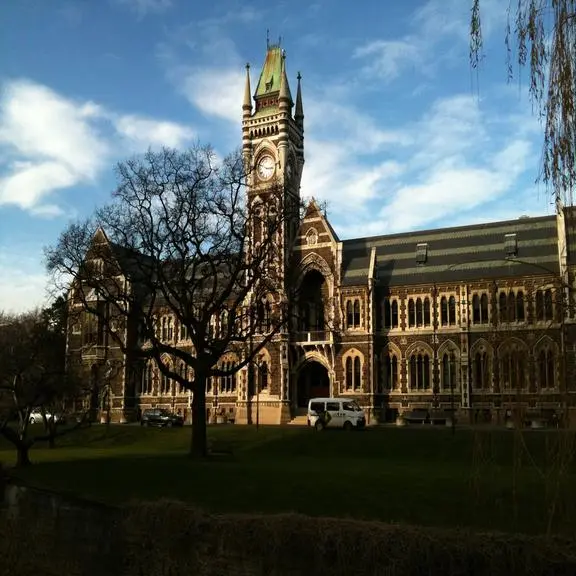
This university, founded in 1869, is one of the oldest in New Zealand. The clock tower at the Registrar's office is an iconic building in Dunedin, with its architecture modeled after the main building at the University of Glasgow. The use of dark basalt and light Oamaru stone creates a strong color contrast. The university is open to visitors and guided tours are available to showcase its beautiful campus and rich history.
309
km