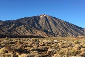
Teide National Park, Awe-inspiring volcanic landscapes above the clouds
Carretera del Teide, La Orotava, Santa Cruz de Tenerife, Canary Islands, Spain
4.8
Introduction
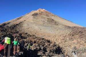
The Teide National Park, which comprises the Teide volcano and its surroundings, covers an area of 18,900 hectares. The park was declared a World Heritage Site in 2007 and is one of the most visited national parks in the Canary Islands and Spain. It is located in a high-altitude area, with elevations exceeding 2,000 meters, and has temperatures below zero degrees Celsius in winter and up to 40 degrees Celsius in summer. The best way to climb to the top of Teide is by cable car, and it is necessary to obtain permission from the Orotava National Park office before climbing. If you choose to climb on foot, it will take about six hours. Before climbing, it is important to choose warm and comfortable clothing and shoes and ensure that you have enough physical strength and body fitness to adapt to the high altitude environment. The most famous sites in the national park include Gran Canaria, La Palma, La Gomera, and El Hierro. During the tour, visitors can stop at appropriate intervals and enjoy the surrounding scenery. Address Carretera del Teide, La Orotava, Santa Cruz de Tenerife, Canary Islands, Spain
Transportation Airplane: Tenerife South airport. There are international flights from different places every day. There is a bus station and car rental companies at the airport.
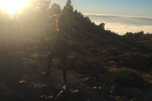
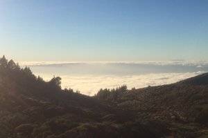
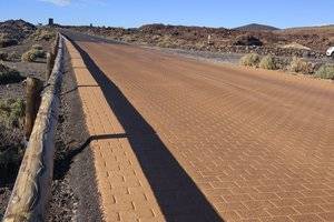
 The terrain and landforms are indeed very unique